File:Grunewalde map.jpg
Jump to navigation
Jump to search
Size of this preview: 490 × 599 pixels. Other resolutions: 1,676 × 2,048 pixels | 4,500 × 5,500 pixels.
Original file (4,500 × 5,500 pixels, file size: 9.99 MB, MIME type: image/jpeg)
Summary
| Description |
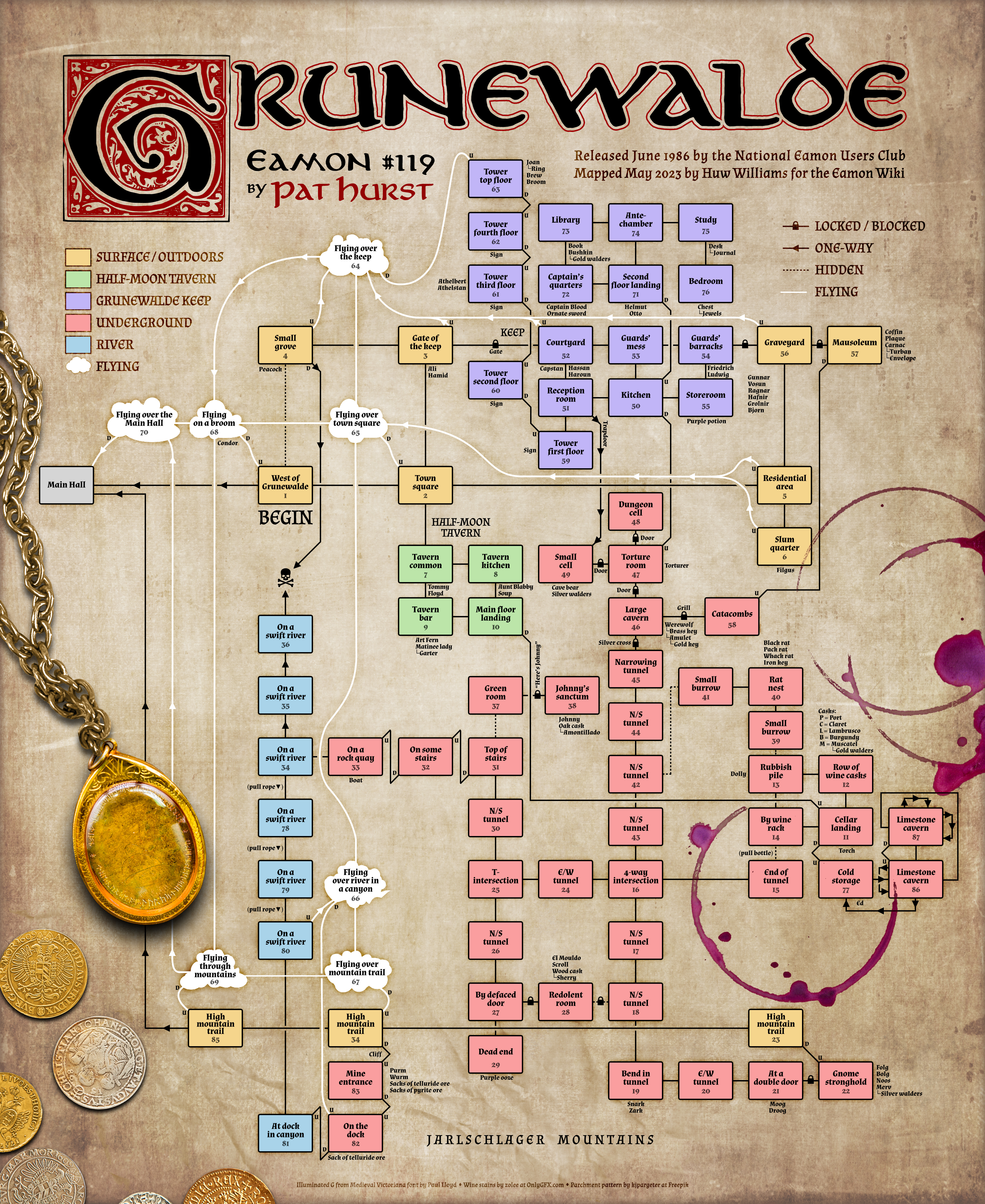
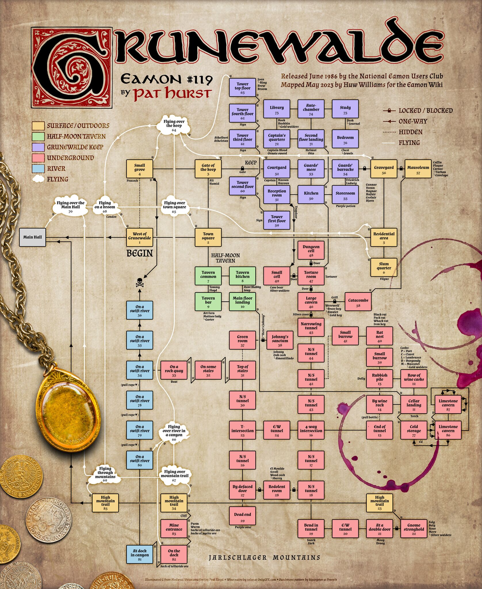
A map of Pat Hurst's adventure Grunewalde. |
|---|---|
| Source | |
| Date |
21 May 2023 |
| Author |
Huw Williams |
| License |
This work is licensed under the Creative Commons Attribution-NonCommercial 4.0 International (CC BY-NC 4.0) |
File history
Click on a date/time to view the file as it appeared at that time.
| Date/Time | Thumbnail | Dimensions | User | Comment | |
|---|---|---|---|---|---|
| current | 17:10, 21 May 2023 | | 4,500 × 5,500 (9.99 MB) | Huwmanbeing (talk | contribs) |
You cannot overwrite this file.
File usage
The following 2 pages use this file: